
-
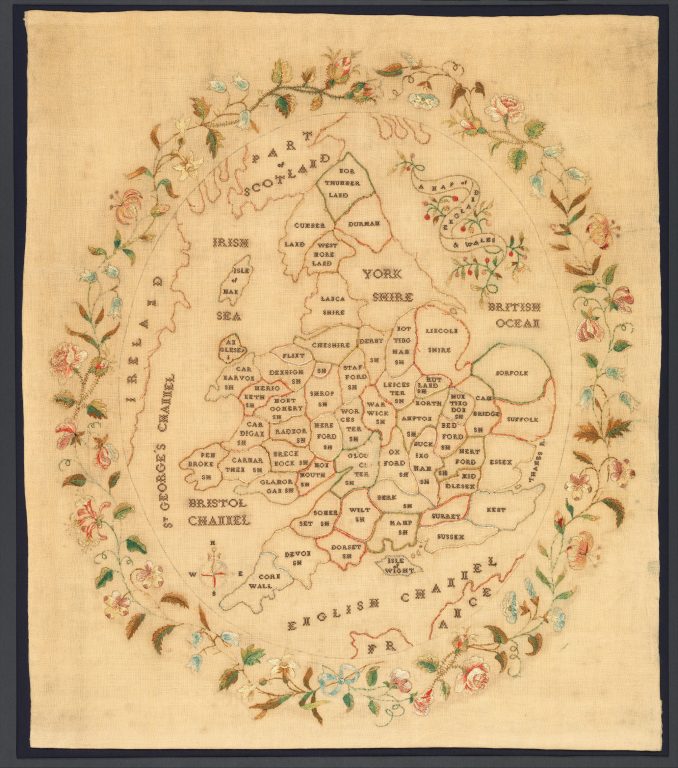
Objecttextile (towels, carpets, etc.): Sampler
-
Type of arts & crafts
-
MediumSilk embroidery on wool
-
SizeH. 22 1/2 x W. 19 1/4 inches (57.2 x 48.9 cm)
-
Geography details
United Kingdom -
Country today
-
Date1835
-
Type of sourceDatabase “Metropolitan Museum of Art”
-
Fund that the source refers toMetropolitan Museum of Art
-
Working an embroidered maps such as this sampler became part of a young girl’s education, starting in the 1770s, and continuing until about the 1840s. The map of England and Wales was so popular that printed versions were available to be stitched, which slightly reduces the potential for learning geography, while retaining the importance of practicing neat embroidery. This example that had the name and the maker written on the frame, is quite late. But the polychrome embroidery on a fine wool foundation has survived in relatively good condition compared to some examples that were made on more fragile silk satin foundations. The addition of colored borders in the counties aids in distinguishing one place from another. Other embroidered maps of geographical features were produced, from individual towns and counties, to the entire world in two hemispheres.


